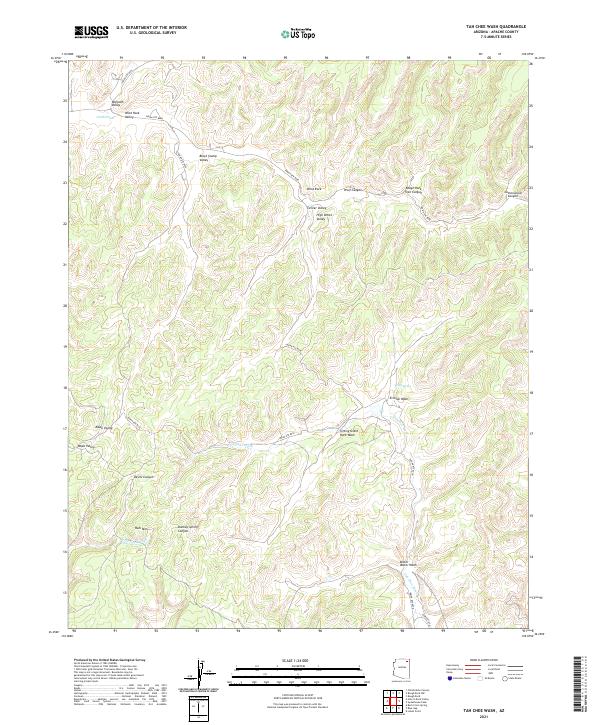
2021 Map of Tah Chee Wash
USGS Topo · Published 2021About this map
Tah-Chee Wash and its associated tributaries dominate this high-desert landscape in northern Arizona, revealing a complex network of seasonal drainages and named valleys. The area is defined by its dramatic landforms, from the prominent Rain Mtn to the depths of Devils Canyon. Local orientation relies on distinct geological markers such as Wind Rock and Sitting Giant Rock Wash. Transportation throughout this part of the Navajo Nation is facilitated by a series of regional routes including Indian Rte 8028 and Indian Rte 8088, which navigate the intervals between Black Stump Valley and Warpath Valley. Rare water sources like Coal Spring serve as critical landmarks in an otherwise arid terrain characterized by expansive erosional features like Erosion Wash and Bitter Water Wash.
Find a feature on this map
31 named features on this map. Tap any name to fly to it.
Don’t see what you’re looking for? This feature index may not catch every label — zoom into the map to look around manually.
Map Details
Editions of this 2021 Tah Chee Wash Map
This is the sole edition of this map. No revisions or reprints were ever made.
Other maps of this area

1883 · Marsh Pass
USGS Topo · 1:250,000

1892 · Marsh Pass
USGS Topo · 1:250,000

1892 · Canyon De Chelly
USGS Topo · 1:250,000

1954 · Shiprock
USGS Topo · 1:250,000

1956 · Marble Canyon
USGS Topo · 1:250,000

1958 · Shiprock
USGS Topo · 1:250,000

1959 · Shiprock
USGS Topo · 1:250,000

1959 · Marble Canyon
USGS Topo · 1:250,000

1961 · Marble Canyon
USGS Topo · 1:250,000
1967 · Burnt Corn Spring
USGS Topo · 1:24,000