2024 Map of Tallassee
USGS Topo · Published 2024About this map
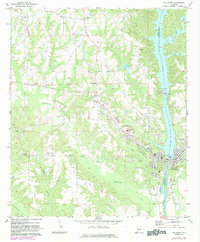
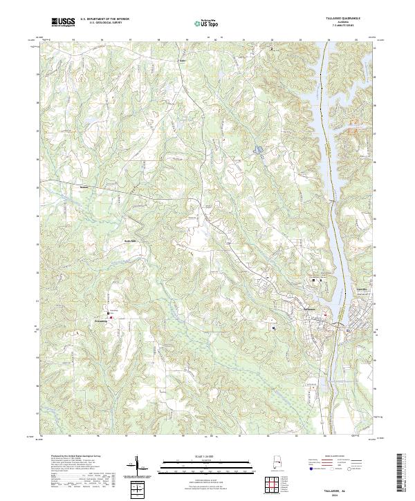
Tallassee and Carrville sit at the core of this Elmore and Tallapoosa County borderlands, where the Tallapoosa River carves a path through the Alabama interior. The landscape is defined by its watercourses, from the winding Wallahatchee Creek in the south to the northern reaches of Sougahatchee Creek. Genealogy and local history are preserved in the distinct demarcations of the Rose Hill Cem Old Section and Rose Hill Cem New Section, alongside outlying burial grounds like Hornsby Cem and Friendship Cem. Rural life radiates from crossroads like Kent and Neman, connected by thoroughfares such as Chana Creek Rd and Hollis Ferry Rd. Notable landmarks like Butts Mill and the infrastructure indicated by Yates Dam Rd hint at the industry and milling history that historically shaped these river communities.
Find a feature on this map
129 named features on this map. Tap any name to fly to it.
Don’t see what you’re looking for? This feature index may not catch every label — zoom into the map to look around manually.
Map Details
Editions of this 2024 Tallassee Map
This is the sole edition of this map. No revisions or reprints were ever made.