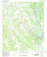
1971 Map of Tallassee
USGS Topo · Published 1984About this map
The Tallapoosa River defines the landscape of this 1971 survey, serving as both a county boundary and a source of industrial power. The river's drop is harnessed by the Yates Dam and the Thurlow Dam Powerhouse near the population centers of Tallassee and Carrville. This edition, revised in the early 1980s, captures the urban expansion of Tallassee west toward Wallahatchee and northward toward Burlington. While industry dominates the riverbank, the surrounding terrain is dotted with small rural communities like Kent and Neman, and numerous country churches including Providence Ch and Chana Creek Ch. The geography reveals a transition from traditional agricultural settlements to a more modern infrastructure, evidenced by the Radio Tower (WTLS) and various Gravel Pits that supported local development. For those tracing local heritage, the map provides precise locations for the Southside Sch and the well-established Rosehill Cem.
Find a feature on this map
43 named features on this map. Tap any name to fly to it.
Don’t see what you’re looking for? This feature index may not catch every label — zoom into the map to look around manually.
Map Details
Editions of this 1971 Tallassee Map
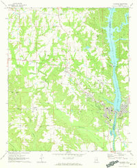
2 editions found
Other maps of this area

1901 · Wetumpka
USGS Topo · 1:125,000

1901 · Wetumpka
USGS Topo · 1:62,500

1903 · Wetumpka
USGS Topo · 1:125,000

1906 · Dadeville
USGS Topo · 1:125,000

1953 · Montgomery
USGS Topo · 1:250,000

1955 · Phenix City
USGS Topo · 1:250,000

1956 · Montgomery
USGS Topo · 1:250,000

1957 · Phenix City
USGS Topo · 1:250,000

1957 · Montgomery
USGS Topo · 1:250,000

1958 · Phenix City
USGS Topo · 1:250,000