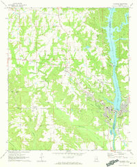
1971 Map of Tallassee
USGS Topo · Published 1973About this map
The Tallapoosa River defines the industrial and geographic character of this region, serving as the county line between Elmore and Tallapoosa counties. Significant hydroelectric infrastructure is anchored here at Yates Dam and Thurlow Dam, with the latter positioned directly adjacent to the commercial heart of Tallassee. The map captures the transition from the dense street grids of the corporate center to the surrounding rural hamlets like Kent, Burlington, and Friendship.
Find a feature on this map
46 named features on this map. Tap any name to fly to it.
Don’t see what you’re looking for? This feature index may not catch every label — zoom into the map to look around manually.
Map Details
Editions of this 1971 Tallassee Map
2 editions found
Other maps of this area

1901 · Wetumpka
USGS Topo · 1:125,000

1901 · Wetumpka
USGS Topo · 1:62,500

1903 · Wetumpka
USGS Topo · 1:125,000

1906 · Dadeville
USGS Topo · 1:125,000

1953 · Montgomery
USGS Topo · 1:250,000

1955 · Phenix City
USGS Topo · 1:250,000

1956 · Montgomery
USGS Topo · 1:250,000

1957 · Phenix City
USGS Topo · 1:250,000

1957 · Montgomery
USGS Topo · 1:250,000

1958 · Phenix City
USGS Topo · 1:250,000