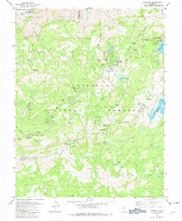
1979 Map of Tamarack
USGS Topo · Published 1979About this map
Bear Valley and the surrounding high-country landscape of the Sierra Nevada are documented here during the late 1970s. The map illustrates a transitional period of recreation and mountain living, featuring planned developments like Sherman Acres alongside rustic outposts such as Del Orto Camp. A significant historical layer is preserved at the Bloods Toll Sta Hist Site, marking a point of passage through the corridor long used by travelers.
Find a feature on this map
63 named features on this map. Tap any name to fly to it.
Don’t see what you’re looking for? This feature index may not catch every label — zoom into the map to look around manually.
Map Details
Editions of this 1979 Tamarack Map
2 editions found
Other maps of this area

1889 · Pyramid Peak
USGS Topo · 1:125,000

1889 · Markleeville
USGS Topo · 1:125,000

1891 · Markleeville
USGS Topo · 1:125,000

1891 · Big Trees
USGS Topo · 1:125,000

1891 · Pyramid Peak
USGS Topo · 1:125,000

1893 · Markleeville
USGS Topo · 1:125,000

1894 · Big Trees
USGS Topo · 1:125,000

1895 · Pyramid Peak
USGS Topo · 1:125,000

1896 · Dardanelles
USGS Topo · 1:125,000

1896 · Pyramid Peak
USGS Topo · 1:125,000