2024 Map of Tampico
USGS Topo · Published 2024About this map
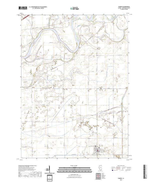
Tampico serves as the primary hub in this portion of Whiteside County, positioned at the southern edge of a landscape defined by its intricate water systems. The Rock River winds through the northern reaches, joined by numerous tributaries and slow-moving wetlands including Spring Slough, Ramsey Slough, and Paddock Slough. This region exhibits a clear grid of rural roads, such as Prophetstown Rd and Hahnaman Rd, that connect isolated farmsteads to the village center. Genealogists will find several significant burial sites documented, including the Old Hume Cem to the north and the Tampico Memorial Cem near the town's edge. The proximity of Saint Marys Cem and the local street names like S Main St and E Kimball St provide a detailed look at the community's organized layout amidst the surrounding drainage of Coon Creek and Ellsworth Creek.
Find a feature on this map
42 named features on this map. Tap any name to fly to it.
Don’t see what you’re looking for? This feature index may not catch every label — zoom into the map to look around manually.
Map Details
Editions of this 2024 Tampico Map
This is the sole edition of this map. No revisions or reprints were ever made.
