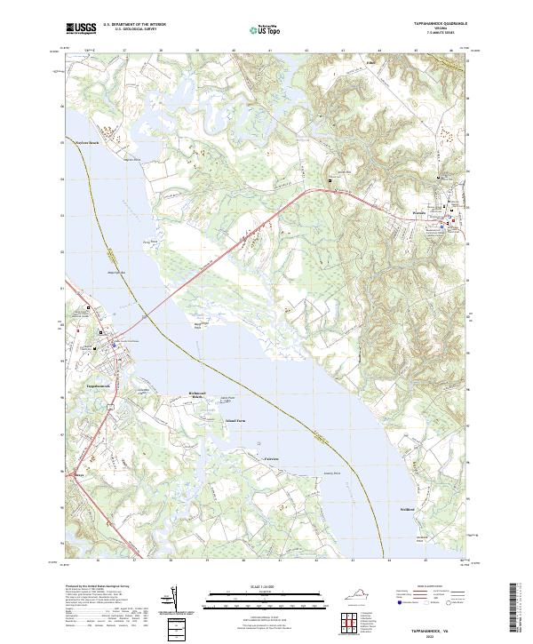
2022 Map of Tappahannock
USGS Topo · Published 2022About this map
The Rappahannock River serves as the central artery of this region, dividing Richmond and Essex counties and shaping the development of the riverfront towns. On the southwestern bank, Tappahannock is anchored by the Essex County Courthouse and numerous historical sites, including Saint Timothy Catholic Church Memorial Garden. Across the water, the town of Warsaw sits inland from Ferry Point, established as a significant center of civic and educational life with the Richmond County Courthouse and the Rappahannock Community College Warsaw Campus.
Find a feature on this map
128 named features on this map. Tap any name to fly to it.
Don’t see what you’re looking for? This feature index may not catch every label — zoom into the map to look around manually.
Map Details
Editions of this 2022 Tappahannock Map
This is the sole edition of this map. No revisions or reprints were ever made.
Other maps of this area

1892 · Piney Point
USGS Topo · 1:62,500

1892 · Montross
USGS Topo · 1:62,500

1894 · Piney Point
USGS Topo · 1:62,500

1895 · Nomini
USGS Topo · 1:125,000

1895 · Piney Point
USGS Topo · 1:62,500

1895 · Montross
USGS Topo · 1:62,500

1898 · Nomini
USGS Topo · 1:125,000

1901 · Piney Point
USGS Topo · 1:62,500

1917 · Morattico
USGS Topo · 1:62,500

1918 · Tappahannock
USGS Topo · 1:62,500