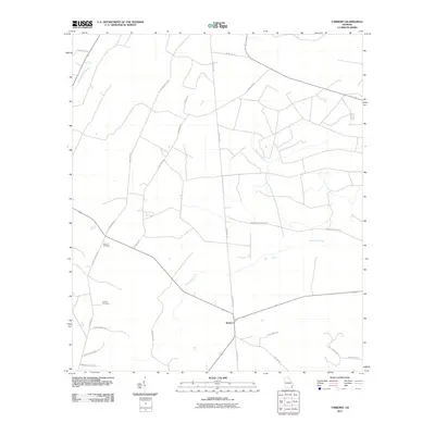
2011 Map of Tarboro
USGS Topo · Published 2011About this map
Tarboro serves as the focal point for this 2011 survey of Camden County, Georgia, situated where several local thoroughfares meet north of White Oak Creek. The landscape is defined by its rural road network and water systems, with Waverly Creek and County Line Branch draining the surrounding coastal plains. For genealogists and local historians, the inclusion of Victory Cemetery and Harrell Cemetery provides specific points for family research, while many roads bear the names of local figures or landmarks, such as Boysie Walker Rd, Sadie Jackson Rd, and Cavader Harrell Rd. The presence of Bickley Chapel Rd and Providence Church Rd suggests the historical locations of community congregations in this largely agricultural region. This map illustrates the intersection of traditional land use and modern infrastructure, including the path of Old Jacksonville Rd.
Find a feature on this map
27 named features on this map. Tap any name to fly to it.
Don’t see what you’re looking for? This feature index may not catch every label — zoom into the map to look around manually.
Map Details
Editions of this 2011 Tarboro Map
This is the sole edition of this map. No revisions or reprints were ever made.
Other maps of this area

1917 · Nahunta
USGS Topo · 1:62,500

1917 · Boulogne
USGS Topo · 1:62,500

1918 · Nahunta
USGS Topo · 1:62,500

1918 · Bladen
USGS Topo · 1:62,500

1918 · Kingsland
USGS Topo · 1:62,500

1919 · Boulogne
USGS Topo · 1:62,500

1939 · Bladen
USGS Topo · 1:62,500

1946 · Brunswick
USGS Topo · 1:250,000

1948 · Jacksonville
USGS Topo · 1:250,000

1948 · Brunswick
USGS Topo · 1:250,000