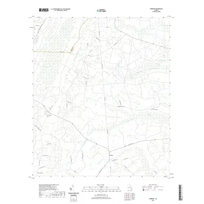
2020 Map of Tarboro
USGS Topo · Published 2020About this map
Tarboro serves as the focal point of this coastal plain landscape, situated at a junction of roads including Burnt Fort Rd and Robinson Hill Rd. The surrounding terrain is defined by an extensive network of wetlands and watercourses, most notably the White Oak Swamp and Tower Swamp, which drain into White Oak Cr. The map reveals a transition from these low-lying swampy areas to the higher ground marked by Kings Bay in the northwest. Local family history is rooted in the presence of several named cemeteries, including Victory Cem and Harrell Cem, situated along historic routes like Old Post Rd. These features, alongside many family-named roads such as Boysie Walker Rd and Sadie Jackson Rd, suggest a landscape deeply tied to long-standing local residents and rural agricultural traditions in this section of Camden County.
Find a feature on this map
38 named features on this map. Tap any name to fly to it.
Don’t see what you’re looking for? This feature index may not catch every label — zoom into the map to look around manually.
Map Details
Editions of this 2020 Tarboro Map
This is the sole edition of this map. No revisions or reprints were ever made.
Other maps of this area

1917 · Nahunta
USGS Topo · 1:62,500

1917 · Boulogne
USGS Topo · 1:62,500

1918 · Nahunta
USGS Topo · 1:62,500

1918 · Bladen
USGS Topo · 1:62,500

1918 · Kingsland
USGS Topo · 1:62,500

1919 · Boulogne
USGS Topo · 1:62,500

1939 · Bladen
USGS Topo · 1:62,500

1946 · Brunswick
USGS Topo · 1:250,000

1948 · Jacksonville
USGS Topo · 1:250,000

1948 · Brunswick
USGS Topo · 1:250,000