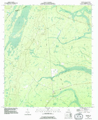
1993 Map of Tarboro
USGS Topo · Published 1995About this map
Tarboro lies at the heart of this low-lying coastal plain landscape, where the geography is defined by a dense network of wetlands and tidal drainage. The White Oak Swamp and White Oak Creek dominate the southeastern quadrant, while Waverly Creek and various unnamed swamps snake through the pine-laden terrain. This 1990s revision reveals the enduring rural character of Camden County, where an Old Railroad Grade and a small Landing Strip indicate past and present transit corridors through the marshy interior. Local history is anchored by sites such as the Harrell Cem and another Cem near Tarboro, alongside landmarks like a Lookout Tower and multiple Flowing Wells. The boundary between Brantley and Camden counties follows the path of Line Branch, reflecting how natural watercourses dictate political lines in this water-rich environment.
Find a feature on this map
15 named features on this map. Tap any name to fly to it.
Don’t see what you’re looking for? This feature index may not catch every label — zoom into the map to look around manually.
Map Details
Editions of this 1993 Tarboro Map
This is the sole edition of this map. No revisions or reprints were ever made.
Other maps of this area

1917 · Nahunta
USGS Topo · 1:62,500

1917 · Boulogne
USGS Topo · 1:62,500

1918 · Nahunta
USGS Topo · 1:62,500

1918 · Bladen
USGS Topo · 1:62,500

1918 · Kingsland
USGS Topo · 1:62,500

1919 · Boulogne
USGS Topo · 1:62,500

1939 · Bladen
USGS Topo · 1:62,500

1946 · Brunswick
USGS Topo · 1:250,000

1948 · Jacksonville
USGS Topo · 1:250,000

1948 · Brunswick
USGS Topo · 1:250,000