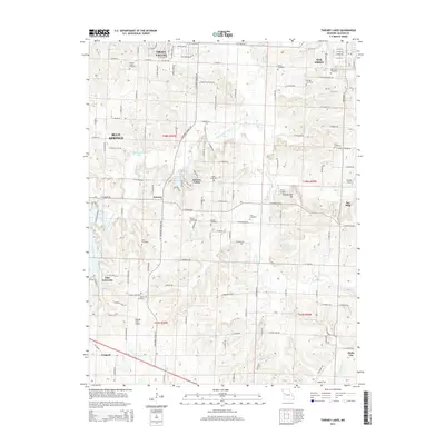
2014 Map of Tarsney Lakes
USGS Topo · Published 2014About this map
Tarsney Lakes and the surrounding Jackson County countryside are defined by the winding course of the Sni-A-Bar Creek and its many forks. This 2014 survey documents a landscape where agricultural roots and suburban expansion meet, showing the progress of communities like Grain Valley, Oak Grove, and Blue Springs. The map reveals a dense network of local family history through its numerous burial grounds, including the Purdee Chapel Cemetery and Gosney Cemetery.
Find a feature on this map
87 named features on this map. Tap any name to fly to it.
Don’t see what you’re looking for? This feature index may not catch every label — zoom into the map to look around manually.
Map Details
Editions of this 2014 Tarsney Lakes Map
This is the sole edition of this map. No revisions or reprints were ever made.
Other maps of this area

1887 · Harrisonville
USGS Topo · 1:125,000

1892 · Harrisonville
USGS Topo · 1:125,000

1894 · Harrisonville
USGS Topo · 1:125,000

1894 · Independence
USGS Topo · 1:125,000

1933 · Blue Springs
USGS Topo · 1:24,000

1934 · Oak Grove
USGS Topo · 1:24,000

1934 · Woods Chapel
USGS Topo · 1:24,000

1935 · Tarsney
USGS Topo · 1:24,000
1945 · Blue Springs
USGS Topo · 1:24,000
1947 · Blue Springs
USGS Topo · 1:31,680