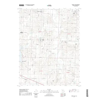
2017 Map of Tarsney Lakes
USGS Topo · Published 2017About this map
The eastern edges of Blue Springs and Grain Valley give way to a transition between residential expansion and the traditional rural landscape of Jackson County. Local topography is dominated by the W Fork Sni-A-Bar Cr and the main Sni-A-Bar Cr, which wind through the center of the sheet toward the older settlement of Sni Mills. Genealogical interest is dense here, with numerous family and community burial grounds including Purdee Chapel Cem, Gosney Cem, and Adams Cem scattered across the township lines. The recreational character of the area is anchored by Tarsney Lakes and the northeastern reach of Lake Lotawana. Small private airstrips like Michael Farm Airport and Powis Airport emphasize the region's low-density development during this period of the twenty-first century.
Find a feature on this map
163 named features on this map. Tap any name to fly to it.
Don’t see what you’re looking for? This feature index may not catch every label — zoom into the map to look around manually.
Map Details
Editions of this 2017 Tarsney Lakes Map
This is the sole edition of this map. No revisions or reprints were ever made.
Other maps of this area

1887 · Harrisonville
USGS Topo · 1:125,000

1892 · Harrisonville
USGS Topo · 1:125,000

1894 · Harrisonville
USGS Topo · 1:125,000

1894 · Independence
USGS Topo · 1:125,000

1933 · Blue Springs
USGS Topo · 1:24,000

1934 · Oak Grove
USGS Topo · 1:24,000

1934 · Woods Chapel
USGS Topo · 1:24,000

1935 · Tarsney
USGS Topo · 1:24,000
1945 · Blue Springs
USGS Topo · 1:24,000
1947 · Blue Springs
USGS Topo · 1:31,680