Loading...
Loading map...2022 Map of Taylorsville
USGS Topo · Published 2022About this map
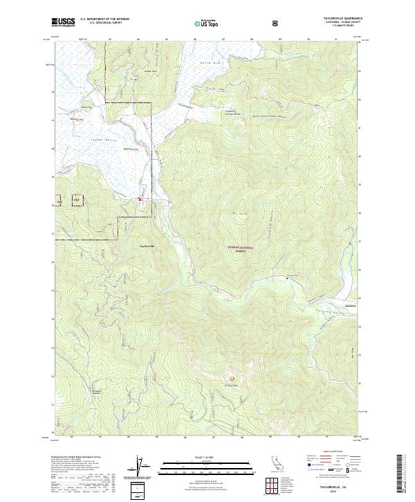
Indian Valley serves as a central hub for the small communities and complex terrain of Plumas County. The settlement of Taylorsville sits at the base of Mt Jura, where the valley floor meets the rising peaks of the Plumas National Forest. To the east, the landscape transitions into the Genesee Valley and the small cluster at Genesee, connected by winding routes like Greenville Genesee Rd.
Find a feature on this map
52 named features on this map. Tap any name to fly to it.
Don’t see what you’re looking for? This feature index may not catch every label — zoom into the map to look around manually.
Map Details
Date Portrayed2022
Date Published2022
PublisherU.S. Geological Survey
Map TypeTopographic
Scale1:24000
Physical Dimensions24 x 29 inches
Editions of this 2022 Taylorsville Map
This is the sole edition of this map. No revisions or reprints were ever made.
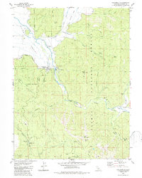
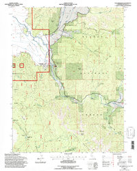
Historical Maps of Genesee Through Time
3 maps found
Featured Locations
Source Details
SourceU.S. Geological Survey
CopyrightPublic Domain