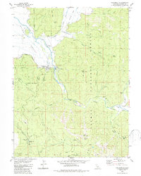
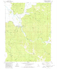
1980 Map of Taylorsville
USGS Topo · Published 1985About this map
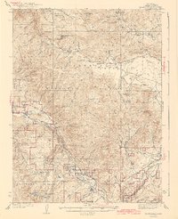
Taylorsville sits at the junction of Indian Creek and Lights Creek, serving as a central hub in the northern Sierras during the mid-1970s. This survey illustrates a landscape deeply shaped by the regional mining economy and early transit routes. Significant historic activity is marked by the Iron Dyke Mine, the King Solomon Mine, and the Taylor Diggings, while the presence of the Emigrant Road and Tollgate Road points to the area's legacy as a vital passage through the mountains. To the south, the Rhinehart Cabin and Rhinehart Meadow suggest earlier homesteading efforts now surrounded by the Plumas National Forest. The map also captures the transition from the broad ranching lands of Indian Valley to the more constrained Genesee Valley, with the isolated Shim Flat Cem providing a quiet genealogical anchor in this topographical study.
Find a feature on this map
50 named features on this map. Tap any name to fly to it.
Don’t see what you’re looking for? This feature index may not catch every label — zoom into the map to look around manually.
Map Details
Editions of this 1980 Taylorsville Map
2 editions found
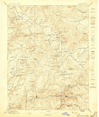
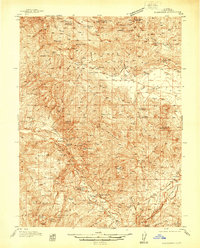
Other maps of this area

1886 · Honey Lake
USGS Topo · 1:250,000

1891 · Downieville
USGS Topo · 1:125,000

1891 · Honey Lake
USGS Topo · 1:250,000

1893 · Honey Lake
USGS Topo · 1:250,000

1893 · Downieville
USGS Topo · 1:125,000

1895 · Downieville
USGS Topo · 1:125,000

1896 · Downieville
USGS Topo · 1:125,000
1897 · Downieville
USGS Topo · 1:125,000
1937 · Blairsden
USGS Topo · 1:48,000
1943 · Blairsden
USGS Topo · 1:62,500