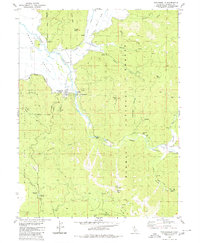
1980 Map of Taylorsville
USGS Topo · Published 1980About this map
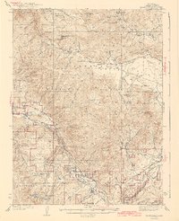
Taylorsville sits at the confluence of Indian Creek and Lights Creek in this 1980 survey, serving as a hub for the high-altitude valleys and mining districts of Plumas County. The map documents a landscape defined by its extractive history and remote settlements, featuring industrial sites like the Iron Dyke Mine and the King Solomon Mine. Further east, the Genesee Valley follows the path of Indian Creek toward the small community of Genesee.
Find a feature on this map
45 named features on this map. Tap any name to fly to it.
Don’t see what you’re looking for? This feature index may not catch every label — zoom into the map to look around manually.
Map Details
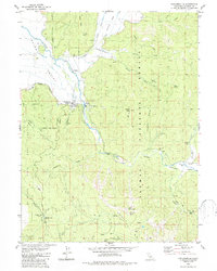
Editions of this 1980 Taylorsville Map
2 editions found
Other maps of this area

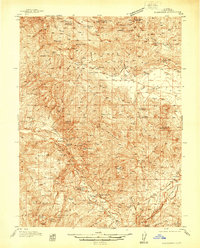
1886 · Honey Lake
USGS Topo · 1:250,000

1891 · Downieville
USGS Topo · 1:125,000

1891 · Honey Lake
USGS Topo · 1:250,000

1893 · Honey Lake
USGS Topo · 1:250,000

1893 · Downieville
USGS Topo · 1:125,000

1895 · Downieville
USGS Topo · 1:125,000

1896 · Downieville
USGS Topo · 1:125,000
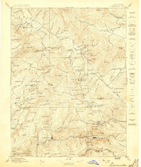
1897 · Downieville
USGS Topo · 1:125,000
1937 · Blairsden
USGS Topo · 1:48,000
1943 · Blairsden
USGS Topo · 1:62,500