
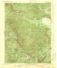
1943 Map of Blairsden
USGS Topo · Published 1943About this map
Walkermine and its associated industrial infrastructure, including the Walker Mine Compressor, define the northern high country of this 1930s survey. The landscape is a complex network of resource extraction and early mountain tourism, where the Western Pacific RR follows the Middle Fork Feather River through the heart of the Plumas National Forest. Settlement patterns are concentrated along this rail corridor at Sloat, Cromberg, and Blairsden, while more remote locations like Johnsville near the Plumas Eureka Mine highlight the area's deep mining roots. The presence of Camp Wieland Feather River Lodge and an Auto Camp indicates the growing role of recreation alongside active timber operations, evidenced by several stretches of Logging RR moving through Clover Valley and the surrounding timber stands.
Find a feature on this map
70 named features on this map. Tap any name to fly to it.
Don’t see what you’re looking for? This feature index may not catch every label — zoom into the map to look around manually.
Map Details
Editions of this 1943 Blairsden Map
3 editions found
Other maps of this area

1886 · Honey Lake
USGS Topo · 1:250,000

1890 · Sierraville
USGS Topo · 1:125,000

1891 · Downieville
USGS Topo · 1:125,000

1891 · Honey Lake
USGS Topo · 1:250,000

1892 · Sierraville
USGS Topo · 1:125,000

1893 · Honey Lake
USGS Topo · 1:250,000

1893 · Downieville
USGS Topo · 1:125,000

1894 · Sierraville
USGS Topo · 1:125,000

1895 · Downieville
USGS Topo · 1:125,000

1896 · Downieville
USGS Topo · 1:125,000