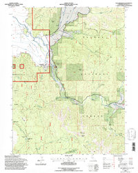
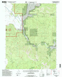
1994 Map of Taylorsville
USGS Topo · Published 1997About this map
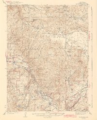
Taylorsville sits at the junction of the mountain-fed waters of Indian Valley, serving as a central hub for this portion of the Plumas National Forest in the mid-1990s. The landscape is defined by the sharp transition from the valley floor to the surrounding heights of Keddie Ridge and Grizzly Mountain. This era reveals a region where traditional land uses and local history remain physically etched into the terrain, from the Rodeo Grounds just outside the main settlement to the remote Rhinehart Cabin ruins located near Rhinehart Meadow. Resource extraction and mountain transit are evidenced by the Iron Dyke Mine and the winding path of the Beardsley Grade. To the southeast, the Genesee Valley corridor follows Indian Creek, providing a passage between high peaks like Mount Jura and Grizzly Peak.
Find a feature on this map
47 named features on this map. Tap any name to fly to it.
Don’t see what you’re looking for? This feature index may not catch every label — zoom into the map to look around manually.
Map Details
Editions of this 1994 Taylorsville Map
2 editions found
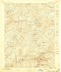
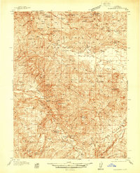
Other maps of this area

1886 · Honey Lake
USGS Topo · 1:250,000

1891 · Downieville
USGS Topo · 1:125,000

1891 · Honey Lake
USGS Topo · 1:250,000

1893 · Honey Lake
USGS Topo · 1:250,000

1893 · Downieville
USGS Topo · 1:125,000

1895 · Downieville
USGS Topo · 1:125,000

1896 · Downieville
USGS Topo · 1:125,000
1897 · Downieville
USGS Topo · 1:125,000
1937 · Blairsden
USGS Topo · 1:48,000
1943 · Blairsden
USGS Topo · 1:62,500