2021 Map of Tea
USGS Topo · Published 2021About this map
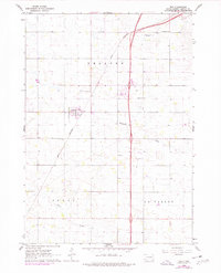
Tea and the southern outskirts of Sioux Falls dominate this modern landscape on the edge of the Coteau des Prairies upland. The map documents a period of rapid suburban expansion and infrastructure development, with dense street grids such as W 69th St and S Louise Ave pushing south toward the traditional farming sections. Regional transportation and aviation are central to this area, evidenced by the Marv Skie-Lincoln County Airport and the Chris-Hofer Landing Strip. Despite the encroaching residential development, local heritage remains preserved at sites like the Tea Cem and Faith LaValley Cem. The natural drainage of the prairie is still visible through the winding paths of Ninemile Cr and Beaver Cr, which cut through the established survey townships of T100N R51W and T99N R50W.
Find a feature on this map
116 named features on this map. Tap any name to fly to it.
Don’t see what you’re looking for? This feature index may not catch every label — zoom into the map to look around manually.
Map Details
Editions of this 2021 Tea Map
This is the sole edition of this map. No revisions or reprints were ever made.