1962 Map of Tea
USGS Topo · Published 1977About this map
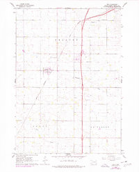
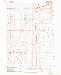
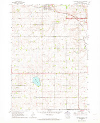
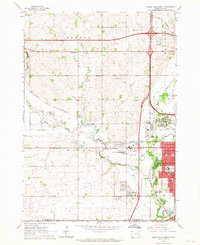
Agricultural patterns in Lincoln County are captured during a period of infrastructure modernization, as evidenced by the corridor of Interstate 29 cutting through the landscape. The small settlement of Tea serves as the focal point, situated at the junction of the Great Northern railroad and local roads. Outside the village, the rural character is defined by a network of sections including Delapre, Perry, and La Valley, where local education and communal life centered on locations like Prairie View Sch and Rader Sch.
Find a feature on this map
13 named features on this map. Tap any name to fly to it.
Don’t see what you’re looking for? This feature index may not catch every label — zoom into the map to look around manually.
Map Details
Editions of this 1962 Tea Map
2 editions found
Other maps of this area

1897 · Canton
USGS Topo · 1:125,000

1900 · Canton
USGS Topo · 1:125,000

1955 · Sioux Falls
USGS Topo · 1:250,000

1958 · Sioux Falls
USGS Topo · 1:250,000
1962 · Harrisburg
USGS Topo · 1:24,000
1962 · Sioux Falls East
USGS Topo · 1:24,000
1962 · Tea
USGS Topo · 1:24,000
1962 · Hartford South
USGS Topo · 1:24,000
1962 · Lennox NW
USGS Topo · 1:24,000
1962 · Sioux Falls West
USGS Topo · 1:24,000