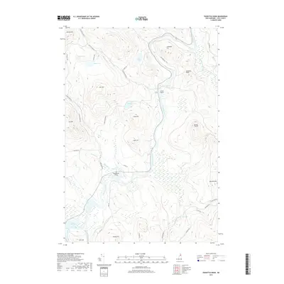
2018 Map of Teakettle Ridge
USGS Topo · Published 2018About this map
The Androscoggin River carves a winding path through the heart of this Coos County landscape, defining the topography of the Dummer area. Significant wetlands and river features dominate the lowlands, including the complex channels of Seven Islands and the broader waters of Pontook Reservoir in the southwest. The terrain is marked by prominent elevations such as Teakettle Ridge, Deer Mtn, and Sugar Hill, which rise sharply from the river valley.
Find a feature on this map
45 named features on this map. Tap any name to fly to it.
Don’t see what you’re looking for? This feature index may not catch every label — zoom into the map to look around manually.
Map Details
Editions of this 2018 Teakettle Ridge Map
This is the sole edition of this map. No revisions or reprints were ever made.
Other maps of this area

1930 · Milan
USGS Topo · 1:62,500

1930 · Percy
USGS Topo · 1:62,500

1930 · Dixville
USGS Topo · 1:62,500

1930 · Errol
USGS Topo · 1:62,500

1933 · Dixville
USGS Topo · 1:62,500

1933 · Milan
USGS Topo · 1:62,500

1934 · Percy
USGS Topo · 1:62,500

1934 · Dixville
USGS Topo · 1:62,500

1934 · Errol
USGS Topo · 1:62,500

1934 · Milan
USGS Topo · 1:62,500