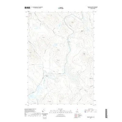
2021 Map of Teakettle Ridge
USGS Topo · Published 2021About this map
The Androscoggin River carves a central path through this Coos County landscape, passing the clusters of Seven Islands and the broad expanse of Wentworth Island. The terrain is defined by high peaks and ridges, from Mt Patience and Deer Mtn in the north to Teakettle Ridge and Double Top Mtn further south. Water is a constant presence, with the Pontook Reservoir dominating the southwestern corner and numerous smaller bodies like Munn Pond and Gapse Pond tucked into the valleys. A network of logging and access roads, such as Millsfield Pond Rd and Tardif Rd, suggests the area's ongoing relationship with the timber industry. The map captures the specialized geography of the North Country, where elevations like Sugar Hill and Pond Hill overlook complex wetland systems and brooks like Mollidgewock Brook.
Find a feature on this map
45 named features on this map. Tap any name to fly to it.
Don’t see what you’re looking for? This feature index may not catch every label — zoom into the map to look around manually.
Map Details
Editions of this 2021 Teakettle Ridge Map
This is the sole edition of this map. No revisions or reprints were ever made.
Other maps of this area

1930 · Milan
USGS Topo · 1:62,500

1930 · Percy
USGS Topo · 1:62,500

1930 · Dixville
USGS Topo · 1:62,500

1930 · Errol
USGS Topo · 1:62,500

1933 · Dixville
USGS Topo · 1:62,500

1933 · Milan
USGS Topo · 1:62,500

1934 · Percy
USGS Topo · 1:62,500

1934 · Dixville
USGS Topo · 1:62,500

1934 · Errol
USGS Topo · 1:62,500

1934 · Milan
USGS Topo · 1:62,500