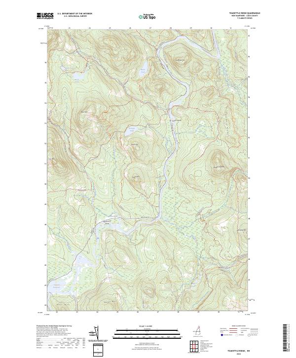
2024 Map of Teakettle Ridge
USGS Topo · Published 2024About this map
The Androscoggin River winds through this North Country landscape, carving a path between significant peaks and the sprawling Umbagog National Wildlife Refuge. The river's course is punctuated by Seven Islands and Wentworth Island, while the southern reaches are dominated by the Pontook Reservoir. The terrain is defined by a series of prominent elevations, including Teakettle Ridge, Double Top Mtn, and Deer Mtn, which overlook a network of high-elevation water bodies like Rock Pond and Moose Pond.
Find a feature on this map
48 named features on this map. Tap any name to fly to it.
Don’t see what you’re looking for? This feature index may not catch every label — zoom into the map to look around manually.
Map Details
Editions of this 2024 Teakettle Ridge Map
This is the sole edition of this map. No revisions or reprints were ever made.
Other maps of this area

1930 · Milan
USGS Topo · 1:62,500

1930 · Percy
USGS Topo · 1:62,500

1930 · Dixville
USGS Topo · 1:62,500

1930 · Errol
USGS Topo · 1:62,500

1933 · Dixville
USGS Topo · 1:62,500

1933 · Milan
USGS Topo · 1:62,500

1934 · Percy
USGS Topo · 1:62,500

1934 · Dixville
USGS Topo · 1:62,500

1934 · Errol
USGS Topo · 1:62,500

1934 · Milan
USGS Topo · 1:62,500