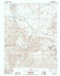
1983 Map of Tecopa
USGS Topo · Published 1983About this map
Tecopa Hot Springs serves as a focal point in this high-desert landscape, where the Amargosa River cuts through the arid valley near the border of Inyo and San Bernardino counties. The map documents the remnants of industrial and transit history, clearly showing an Old RR Grade and the path of the Old Spanish Trail Highway as they navigate the desert terrain. These routes link several small settlements and historical locations, including Tecopa, the Acme (Site), and China Ranch.
Find a feature on this map
22 named features on this map. Tap any name to fly to it.
Don’t see what you’re looking for? This feature index may not catch every label — zoom into the map to look around manually.
Map Details
Editions of this 1983 Tecopa Map
This is the sole edition of this map. No revisions or reprints were ever made.
Other maps of this area

1933 · Avawatz Mountains
USGS Topo · 1:250,000

1947 · Trona
USGS Topo · 1:250,000

1948 · Trona
USGS Topo · 1:250,000

1948 · Avawatz Pass
USGS Topo · 1:62,500

1950 · Tecopa
USGS Topo · 1:62,500

1951 · Avawatz Pass
USGS Topo · 1:62,500

1951 · Tecopa
USGS Topo · 1:62,500

1951 · Shoshone
USGS Topo · 1:62,500

1953 · Trona
USGS Topo · 1:250,000

1956 · Silurian Hills
USGS Topo · 1:62,500