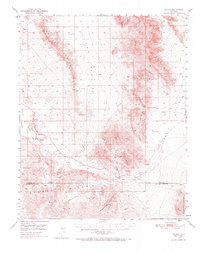
1950 Map of Tecopa
USGS Topo · Published 1973About this map
Tecopa and the Amargosa River valley are captured here mid-century, defined by a landscape of desert mining and remote settlements. The survey documents a period of industrial transition, featuring a prominent Dismantled Railroad that once connected these desert outposts to larger markets. Mining activity is concentrated in the southern highlands, where sites like the Gunsight Mine, Noonday Mine, and War Eagle Mine are situated near the Mine Camp and Tecopa Pass.
Find a feature on this map
30 named features on this map. Tap any name to fly to it.
Don’t see what you’re looking for? This feature index may not catch every label — zoom into the map to look around manually.
Map Details
Editions of this 1950 Tecopa Map
3 editions found

Other maps of this area

1907 · Las Vegas
USGS Topo · 1:250,000

1908 · Furnace Creek
USGS Topo · 1:250,000

1908 · Las Vegas
USGS Topo · 1:250,000

1910 · Furnace Creek
USGS Topo · 1:250,000

1910 · Ivanpah
USGS Topo · 1:250,000

1912 · Ivanpah
USGS Topo · 1:250,000

1933 · Avawatz Mountains
USGS Topo · 1:250,000

1940 · Eagle Tank
USGS Topo · 1:62,500

1942 · Ivanpah
USGS Topo · 1:250,000

1947 · Trona
USGS Topo · 1:250,000