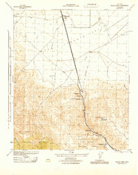
1945 Map of Tecuya Creek
USGS Topo · Published 1945About this map
Industrial and logistical infrastructure dominates this 1940s survey of the mountain pass where the San Joaquin Valley meets the high country. The alignment of U.S. Route 99 serves as the central spine of the map, flanked by vital energy infrastructure including the Richfield Oil Co Pumping Sta, the General Petroleum Corp Rose Station, and the General Petroleum Corp Pumping St near the settlement of Grapevine. These facilities underscore the region's importance as a corridor for moving California's oil and commerce.
Find a feature on this map
19 named features on this map. Tap any name to fly to it.
Don’t see what you’re looking for? This feature index may not catch every label — zoom into the map to look around manually.
Map Details
Editions of this 1945 Tecuya Creek Map
This is the sole edition of this map. No revisions or reprints were ever made.
Other maps of this area

1903 · Mt. Pinos
USGS Topo · 1:125,000

1903 · Tejon
USGS Topo · 1:125,000

1910 · Buena Vista Lake
USGS Topo · 1:125,000

1912 · Buena Vista Lake
USGS Topo · 1:125,000

1914 · Caliente
USGS Topo · 1:125,000

1931 · West of Tejon Hills
USGS Topo · 1:31,680

1931 · Tejon Hills
USGS Topo · 1:31,680

1933 · Tejon Hills
USGS Topo · 1:31,680
1934 · West of Tejon Hills
USGS Topo · 1:31,680
1934 · Coal Oil Canyon
USGS Topo · 1:31,680