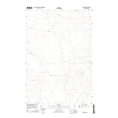
2014 Map of Telos Brook
USGS Topo · Published 2014About this map
Nesowadnehunk Lake and Telos Lake anchor the northeastern landscape of this interior Maine terrain, where a complex network of logging and access roads crisscrosses the North Maine Woods. This modern digital survey documents a region defined by its hydrography, showing how the E Br Ripogenus Stream and W Br Ripogenus Stream drain the southern heights. The road network reveals a pragmatic nomenclature of the timber industry, with routes like Old Telos Rd, Harvester Rd, and the curiously named Useless Rd carving paths through the forest. Significant water bodies like Telos Brook and Cuxabexis Stream weave between these timber tracks, illustrating the watershed's role in the historic and modern navigation of the northern wilderness. The presence of Turnpike Rd suggests established thoroughfares used to transport equipment and resources through this remote Piscataquis County township.
Find a feature on this map
23 named features on this map. Tap any name to fly to it.
Don’t see what you’re looking for? This feature index may not catch every label — zoom into the map to look around manually.
Map Details
Editions of this 2014 Telos Brook Map
This is the sole edition of this map. No revisions or reprints were ever made.
Other maps of this area

1953 · Telos Lake
USGS Topo · 1:62,500

1954 · Chesuncook
USGS Topo · 1:62,500

1954 · Grant Farm
USGS Topo · 1:62,500

1954 · Harrington Lake
USGS Topo · 1:62,500

1954 · Presque Isle
USGS Topo · 1:250,000

1954 · Millinocket
USGS Topo · 1:250,000

1957 · Telos Lake
USGS Topo · 1:62,500

1958 · Presque Isle
USGS Topo · 1:250,000

1958 · Millinocket
USGS Topo · 1:250,000

1958 · Chesuncook
USGS Topo · 1:62,500