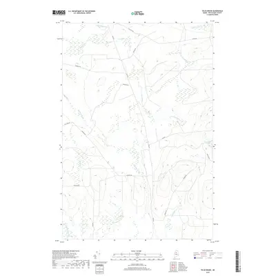
2018 Map of Telos Brook
USGS Topo · Published 2018About this map
Telos Brook and the surrounding timberlands of Piscataquis County are defined by an intricate network of waterways and logging corridors. This modern survey illustrates the specialized transport infrastructure of the North Maine Woods, where routes like Harvester Rd, Turnpike Rd, and the curiously named Useless Rd crisscross the landscape to reach remote timber stands. The drainage patterns are dominated by Telos Stream and Cuxabexis Stream, which eventually feed into the larger river systems of the region. On the eastern margin, the shoreline of Nesowadnehunk Lake appears, a significant landmark for those tracking historical recreational and industrial use of these highlands. The map serves as a record of the managed forest, showing how historical thoroughfares like Old Telos Rd have been supplemented by a dense web of secondary haul roads to manage the flow of wood and water through the basin.
Find a feature on this map
22 named features on this map. Tap any name to fly to it.
Don’t see what you’re looking for? This feature index may not catch every label — zoom into the map to look around manually.
Map Details
Editions of this 2018 Telos Brook Map
This is the sole edition of this map. No revisions or reprints were ever made.
Other maps of this area

1953 · Telos Lake
USGS Topo · 1:62,500

1954 · Chesuncook
USGS Topo · 1:62,500

1954 · Grant Farm
USGS Topo · 1:62,500

1954 · Harrington Lake
USGS Topo · 1:62,500

1954 · Presque Isle
USGS Topo · 1:250,000

1954 · Millinocket
USGS Topo · 1:250,000

1957 · Telos Lake
USGS Topo · 1:62,500

1958 · Presque Isle
USGS Topo · 1:250,000

1958 · Millinocket
USGS Topo · 1:250,000

1958 · Chesuncook
USGS Topo · 1:62,500