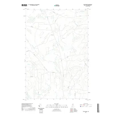
2021 Map of Telos Brook
USGS Topo · Published 2021About this map
Telos Brook and its many tributaries, including Telos Stream and Midnight Brook, dominate this landscape in north-central Maine as it was documented in 2021. The drainage patterns of the north woods are clearly defined, with Cuxabexis Stream and Soper Brook flowing through a region where traditional logging roads and modern forestry paths provide the only overland access. The presence of Old Telos Rd and Turnpike Rd suggests the long-standing importance of this corridor for industrial and recreational transit. The terrain transitions from the low wetlands around Meadow Brook to the more complex topography near Carlton Brook, reflecting the remote character of Piscataquis County timberlands. This map provides a detailed view of the watershed before these streams reach larger water bodies, offering a precise look at the backcountry infrastructure including Useless Rd and Harvester Rd.
Find a feature on this map
22 named features on this map. Tap any name to fly to it.
Don’t see what you’re looking for? This feature index may not catch every label — zoom into the map to look around manually.
Map Details
Editions of this 2021 Telos Brook Map
This is the sole edition of this map. No revisions or reprints were ever made.
Other maps of this area

1953 · Telos Lake
USGS Topo · 1:62,500

1954 · Chesuncook
USGS Topo · 1:62,500

1954 · Grant Farm
USGS Topo · 1:62,500

1954 · Harrington Lake
USGS Topo · 1:62,500

1954 · Presque Isle
USGS Topo · 1:250,000

1954 · Millinocket
USGS Topo · 1:250,000

1957 · Telos Lake
USGS Topo · 1:62,500

1958 · Presque Isle
USGS Topo · 1:250,000

1958 · Millinocket
USGS Topo · 1:250,000

1958 · Chesuncook
USGS Topo · 1:62,500