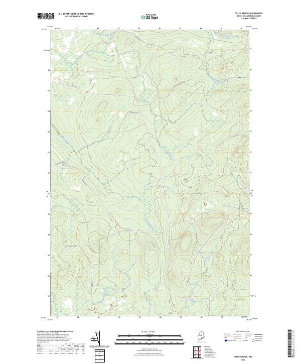
2024 Map of Telos Brook
USGS Topo · Published 2024About this map
Telos Brook and the winding Cuxabexis Stream dominate this Piscataquis County landscape, a region defined by its complex network of waterways and timber-management infrastructure. The topography is marked by a series of brooks, including Soper Brook, Carlton Brook, and Red Brook, which feed into the larger stream systems that characterize the North Maine Woods. This area, largely unsettled by permanent towns, reflects a modern era of industrial forestry, evidenced by the intricate system of logging roads and corridors. Named routes such as Telos Rd, Old Telos Rd, and the curiously named Useless Rd crisscross the drainage basins of Telos Stream and Midnight Brook. These paths follow the natural contours of the land, providing access to the dense woodlands and wetlands that drain south toward the East Branch Ripogenus Stream.
Find a feature on this map
21 named features on this map. Tap any name to fly to it.
Don’t see what you’re looking for? This feature index may not catch every label — zoom into the map to look around manually.
Map Details
Editions of this 2024 Telos Brook Map
This is the sole edition of this map. No revisions or reprints were ever made.
Other maps of this area

1953 · Telos Lake
USGS Topo · 1:62,500

1954 · Chesuncook
USGS Topo · 1:62,500

1954 · Grant Farm
USGS Topo · 1:62,500

1954 · Harrington Lake
USGS Topo · 1:62,500

1954 · Presque Isle
USGS Topo · 1:250,000

1954 · Millinocket
USGS Topo · 1:250,000

1957 · Telos Lake
USGS Topo · 1:62,500

1958 · Presque Isle
USGS Topo · 1:250,000

1958 · Millinocket
USGS Topo · 1:250,000

1958 · Chesuncook
USGS Topo · 1:62,500