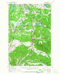
1959 Map of Tenino
USGS Topo · Published 1967About this map
The Skookumchuck River and Deschutes River valleys define this 1959 landscape, where the prairie lands of southern Thurston County meet the rising timber of Northcraft Mtn and Crawford Mtn. The region is a dense network of transportation and industry, anchored by the coal and timber hub of Tenino and the river town of Bucoda. The intricate rail infrastructure includes the Northern Pacific Railroad and the Chicago Milwaukee St Paul and Pacific, which supported the various mines dotting the hills near Tono.
Find a feature on this map
68 named features on this map. Tap any name to fly to it.
Don’t see what you’re looking for? This feature index may not catch every label — zoom into the map to look around manually.
Map Details
Editions of this 1959 Tenino Map
This is the sole edition of this map. No revisions or reprints were ever made.
Other maps of this area

1916 · Chehalis
USGS Topo · 1:125,000

1937 · Olympia
USGS Topo · 1:62,500

1939 · Shelton
USGS Topo · 1:62,500

1940 · Tenino
USGS Topo · 1:62,500

1940 · Anderson Island
USGS Topo · 1:62,500

1941 · Meskill
USGS Topo · 1:62,500

1941 · Gate
USGS Topo · 1:62,500

1943 · Willapa
USGS Topo · 1:62,500

1944 · Tenino
USGS Topo · 1:62,500

1944 · Yelm
USGS Topo · 1:62,500