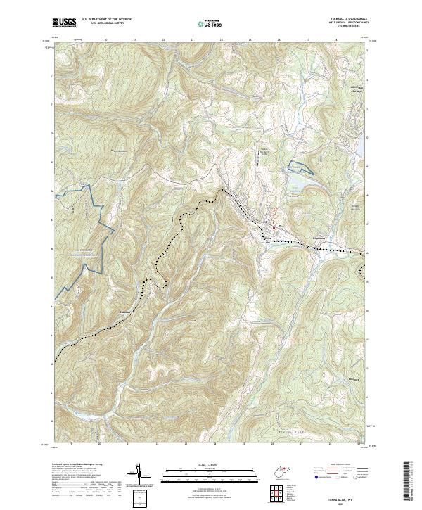
2023 Map of Terra Alta
USGS Topo · Published 2023About this map
Terra Alta occupies the high plateau of the Allegheny Mountains in Preston County, where the historic mountain town is centered around the CSX Transportation railroad line. The settlement pattern is defined by the steep ridges of the Briery Mountains and the Brushy Knobs, with local life clustered near water sources like Terra Alta Lake and Gills Spring. To the east, the Hopemont area serves as a significant landmark, while the surrounding landscape is carved by a complex network of runs and creeks, including Saltlick Creek and the South Branch Snowy Creek.
Find a feature on this map
110 named features on this map. Tap any name to fly to it.
Don’t see what you’re looking for? This feature index may not catch every label — zoom into the map to look around manually.
Map Details
Editions of this 2023 Terra Alta Map
This is the sole edition of this map. No revisions or reprints were ever made.
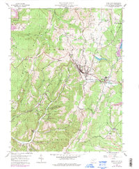
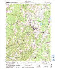
Historical Maps of Alpine Lake Through Time
3 maps found