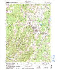
1999 Map of Terra Alta
USGS Topo · Published 2000About this map
Terra Alta occupies a high-elevation plateau in Preston County, where the topography of Portland and Mount Airy meets the industrial and institutional history of northern West Virginia. The town sits as a focal point for the B & O RR, which carves through the terrain with a significant 3 Tracks section. To the east, the State Tuberculosis Sanitarium near Hopemont highlights the area's history as a site for public health facilities, likely chosen for its mountain air. The landscape is dotted with rural identifiers of the late twentieth century, including Lime Plant Sch and numerous country churches like Whitedale Ch and Wesley Chapel. Water features such as Terra Alta Lake and Hulls Lake provide contrast to the surrounding ridges and the mining activity indicated by a Strip Mine and Ash Dumps to the northwest near Elsey.
Find a feature on this map
46 named features on this map. Tap any name to fly to it.
Don’t see what you’re looking for? This feature index may not catch every label — zoom into the map to look around manually.
Map Details
Editions of this 1999 Terra Alta Map
This is the sole edition of this map. No revisions or reprints were ever made.
Other maps of this area

1886 · St. George
USGS Topo · 1:125,000

1891 · St. George
USGS Topo · 1:125,000

1895 · Piedmont
USGS Topo · 1:125,000

1899 · Oakland
USGS Topo · 1:62,500

1900 · Accident
USGS Topo · 1:62,500

1900 · Oakland
USGS Topo · 1:62,500

1904 · Bruceton
USGS Topo · 1:62,500

1907 · Kingwood
USGS Topo · 1:62,500

1925 · Kingwood
USGS Topo · 1:62,500

1926 · Bruceton
USGS Topo · 1:62,500