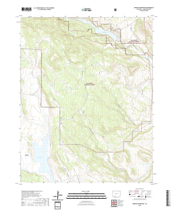
2022 Map of Terrace Reservoir
USGS Topo · Published 2022About this map
The Alamosa River and its upper tributaries anchor this high-altitude landscape within the Rio Grande National Forest. The geography is defined by a system of water management and high-country transit, where the Terrace Reservoir and La Jara Reservoir regulate the flow through narrow canyons and meadows. This survey details a network of Forest Service roads and trails, such as the Hot Creek Trl and Chaquita Peak Trl, which navigate the complex terrain around Jacobs Hill and Bald Ridge. The drainage patterns of La Jara Cr, Piedrosa Cr, and Poso Cr reveal a landscape carved by seasonal runoff. Remote landmarks like Little Brown Lake and La Jara Meadows provide specific points of reference for those studying the hydrological and recreational development of Conejos County.
Find a feature on this map
39 named features on this map. Tap any name to fly to it.
Don’t see what you’re looking for? This feature index may not catch every label — zoom into the map to look around manually.
Map Details
Editions of this 2022 Terrace Reservoir Map
This is the sole edition of this map. No revisions or reprints were ever made.
Other maps of this area

1922 · Conejos
USGS Topo · 1:125,000

1945 · Durango
USGS Topo · 1:250,000

1953 · Durango
USGS Topo · 1:250,000

1954 · Durango
USGS Topo · 1:250,000

1961 · Durango
USGS Topo · 1:250,000

1963 · Durango
USGS Topo · 1:250,000

1966 · Durango
USGS Topo · 1:250,000
1967 · Spectacle Lake
USGS Topo · 1:24,000
1967 · La Jara Canyon
USGS Topo · 1:24,000
1967 · Jasper
USGS Topo · 1:24,000