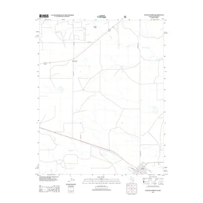
2012 Map of Texline North
USGS Topo · Published 2012About this map
Texline sits at the southern edge of this high plains survey, where the border between New Mexico and Texas is traced through the grid of ranch roads and intermittent creek beds. The landscape is defined by its drainage systems, including the westward-flowing Apache Cr which carves through Apache Valley in the north, and Junkyard Cr and Perico Cr in the south. These seasonal waterways underscore the arid nature of the high desert plateau, where life and industry revolve around the land's utility.
Find a feature on this map
17 named features on this map. Tap any name to fly to it.
Don’t see what you’re looking for? This feature index may not catch every label — zoom into the map to look around manually.
Map Details
Editions of this 2012 Texline North Map
This is the sole edition of this map. No revisions or reprints were ever made.
Other maps of this area

1954 · Dalhart
USGS Topo · 1:250,000

1958 · Dalhart
USGS Topo · 1:250,000

1962 · Dalhart
USGS Topo · 1:250,000

1969 · Felt SW
USGS Topo · 1:24,000

1970 · Texline South
USGS Topo · 1:24,000

1970 · Clayton
USGS Topo · 1:24,000

1970 · Clayton SW
USGS Topo · 1:24,000

1970 · Texline North
USGS Topo · 1:24,000

1972 · Rardin Hill
USGS Topo · 1:24,000
1972 · Rabbit Ear Mountain
USGS Topo · 1:24,000