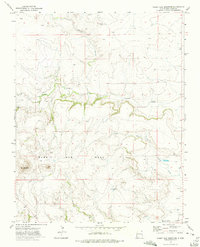
1972 Map of Rabbit Ear Mountain
USGS Topo · Published 1975About this map
Rabbit Ear Mountain serves as the primary landmark of this high plains landscape, rising above the expansive Rabbit Ear Mesa in the northeastern corner of New Mexico. The area's settlement pattern is defined by rural community nodes like Wanette, where the local history is anchored by the Wanette Cem. These small ranching and farming hubs are linked by a network of drainage systems, most notably Seneca Creek and Alamos Creek, which carve distinct paths through the mesa country. Evidence of earlier habitation and land use is visible in the scattered markers for Eklund and the southern Apache Valley. The map also captures the essential water infrastructure of the era, noting numerous wells and springs critical for survival in the arid high desert, alongside a Gravel Pit that points to local extraction and road-building efforts.
Find a feature on this map
17 named features on this map. Tap any name to fly to it.
Don’t see what you’re looking for? This feature index may not catch every label — zoom into the map to look around manually.
Map Details
Editions of this 1972 Rabbit Ear Mountain Map
This is the sole edition of this map. No revisions or reprints were ever made.
Other maps of this area

1954 · Dalhart
USGS Topo · 1:250,000

1958 · Dalhart
USGS Topo · 1:250,000

1962 · Dalhart
USGS Topo · 1:250,000

1966 · Royce
USGS Topo · 1:24,000

1970 · Clayton
USGS Topo · 1:24,000

1970 · Texline North
USGS Topo · 1:24,000

1972 · Seneca
USGS Topo · 1:24,000

1972 · Mc Laughlin Bridge
USGS Topo · 1:24,000

1972 · Bible Top Butte
USGS Topo · 1:24,000

1972 · Rardin Hill
USGS Topo · 1:24,000