
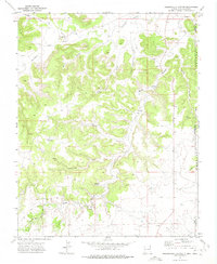
1972 Map of Seneca
USGS Topo · Published 1974About this map
The Santa Fe Trail (Cimarron Cutoff) cuts across this high plains landscape of Union County, providing a clear view of the historic westward passage through northeastern New Mexico in the early 1970s. The small settlement of Seneca is situated in the southeastern corner, serving as a focal point in a region defined by its complex drainage network. Water is a defining element of the geography, with Corrumpa Creek and Alamos Creek winding through the terrain, while landmarks like Lookout Hill and the distinctive formation known as The Pyramid rise above the surrounding flats.
Find a feature on this map
16 named features on this map. Tap any name to fly to it.
Don’t see what you’re looking for? This feature index may not catch every label — zoom into the map to look around manually.
Map Details
Editions of this 1972 Seneca Map
This is the sole edition of this map. No revisions or reprints were ever made.
Other maps of this area

1954 · Dalhart
USGS Topo · 1:250,000

1958 · Dalhart
USGS Topo · 1:250,000

1962 · Dalhart
USGS Topo · 1:250,000

1972 · Mc Laughlin Bridge
USGS Topo · 1:24,000

1972 · Bible Top Butte
USGS Topo · 1:24,000

1972 · Cuates School
USGS Topo · 1:24,000

1972 · Atencio
USGS Topo · 1:24,000

1972 · Rardin Hill
USGS Topo · 1:24,000

1972 · Moses
USGS Topo · 1:24,000
1972 · Greendailey Canyon
USGS Topo · 1:24,000