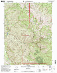
1995 Map of Thatcher Ridge
USGS Topo · Published 2001About this map
Thatcher Ridge and the surrounding high country of the Mendocino National Forest define this 1995 revision of mid-century topography. The landscape is marked by a complex network of named peaks and ridges, including Horse Pasture Ridge and Meeting Camp Ridge, which overlook the deep drainages of the Eel River. The interior of the Hayshed Basin contains isolated landmarks like Poison Rock and Table Rock, suggesting a rugged terrain used for seasonal grazing and back-country access.
Find a feature on this map
40 named features on this map. Tap any name to fly to it.
Don’t see what you’re looking for? This feature index may not catch every label — zoom into the map to look around manually.
Map Details
Editions of this 1995 Thatcher Ridge Map
This is the sole edition of this map. No revisions or reprints were ever made.
Other maps of this area

1926 · Covelo
USGS Topo · 1:62,500

1929 · Eden Valley
USGS Topo · 1:62,500

1952 · Hull Mountain
USGS Topo · 1:62,500

1952 · Eden Valley
USGS Topo · 1:62,500

1952 · Covelo
USGS Topo · 1:62,500

1952 · Anthony Peak
USGS Topo · 1:62,500

1957 · Ukiah
USGS Topo · 1:250,000

1960 · Ukiah
USGS Topo · 1:250,000
1966 · Sanhedrin Mtn
USGS Topo · 1:24,000
1966 · Brushy Mtn
USGS Topo · 1:24,000