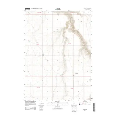
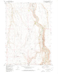
2013 Map of The Arch
USGS Topo · Published 2013About this map
Jarbidge River carves a deep, winding path through the high desert landscape of Owyhee County, creating the dramatic topographical relief seen in Arch Canyon. This 2013 survey illustrates a transition between the elevated flats of the Inside Desert and the Diamond A Desert, where water sources like Cougar Spring and Rocky Lake remain vital points of interest in an otherwise arid expanse. The namesake of the quadrangle, The Arch, is situated along the canyon rim, overlooking a complex system of drainage from Cougar Cr. Human activity in this remote corner of Idaho is sparsely indicated, centered primarily on Larios Camp and the plateau of Arch Table, providing a detailed view of the region's natural landmarks and the Crater Hole geological feature.
Find a feature on this map
17 named features on this map. Tap any name to fly to it.
Don’t see what you’re looking for? This feature index may not catch every label — zoom into the map to look around manually.
Map Details
Editions of this 2013 The Arch Map
This is the sole edition of this map. No revisions or reprints were ever made.
Other maps of this area

1955 · Twin Falls
USGS Topo · 1:250,000

1958 · Twin Falls
USGS Topo · 1:250,000

1978 · The Arch
USGS Topo · 1:24,000

1979 · Cowan Reservoir
USGS Topo · 1:24,000

1979 · Indian Hot Springs
USGS Topo · 1:24,000
1979 · Triguero Lake
USGS Topo · 1:24,000
1979 · Dishpan
USGS Topo · 1:24,000

1979 · Clover Butte South
USGS Topo · 1:24,000
1979 · Poison Butte
USGS Topo · 1:24,000
1979 · Triplet Butte
USGS Topo · 1:24,000