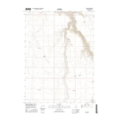
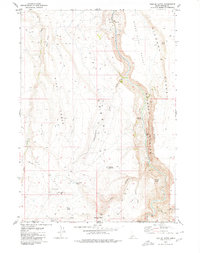
2017 Map of The Arch
USGS Topo · Published 2017About this map
The Arch stands as a prominent landmark within the steep, winding corridor of Arch Canyon, where the Jarbidge River cuts deeply through the high plateaus of Owyhee County. This remote corner of Idaho is characterized by expansive, arid tablelands, including the Diamond A Desert to the west and the Inside Desert to the east. The landscape's volcanic origins are suggested by features like the Crater Hole near Arch Table, while the scarce water sources are marked by labels like Cougar Spring and the ephemeral Cougar Cr. The map's contour lines reveal the dramatic verticality of the river's canyon, which drops hundreds of feet from the surrounding desert flats, creating a natural barrier that has historically dictated movement through this high-desert environment.
Find a feature on this map
15 named features on this map. Tap any name to fly to it.
Don’t see what you’re looking for? This feature index may not catch every label — zoom into the map to look around manually.
Map Details
Editions of this 2017 The Arch Map
This is the sole edition of this map. No revisions or reprints were ever made.
Other maps of this area

1955 · Twin Falls
USGS Topo · 1:250,000

1958 · Twin Falls
USGS Topo · 1:250,000

1978 · The Arch
USGS Topo · 1:24,000

1979 · Cowan Reservoir
USGS Topo · 1:24,000

1979 · Indian Hot Springs
USGS Topo · 1:24,000
1979 · Triguero Lake
USGS Topo · 1:24,000
1979 · Dishpan
USGS Topo · 1:24,000

1979 · Clover Butte South
USGS Topo · 1:24,000
1979 · Poison Butte
USGS Topo · 1:24,000
1979 · Triplet Butte
USGS Topo · 1:24,000