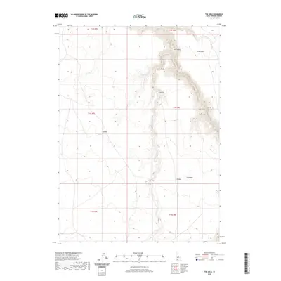
2020 Map of The Arch
USGS Topo · Published 2020About this map
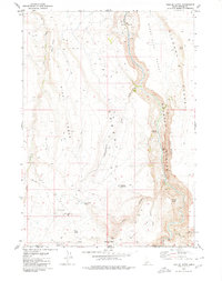
Jarbidge River carves a deep, winding path through the high desert of Owyhee County, creating a dramatic landscape of steep canyons and flat-topped tables. This 2020 survey illustrates the isolation of the region, where the river's course is flanked by Arch Canyon and the prominent landmark of The Arch. The terrain transitions from the open expanse of Inside Desert in the northeast to the Diamond A Desert in the west, with geological features like Crater Hole and Arch Table marking the rimlands. Seasonal water sources such as Cougar Cr and Cougar Spring are critical points in this arid environment, which remains largely defined by its natural topography rather than human settlement.
Find a feature on this map
15 named features on this map. Tap any name to fly to it.
Don’t see what you’re looking for? This feature index may not catch every label — zoom into the map to look around manually.
Map Details
Editions of this 2020 The Arch Map
This is the sole edition of this map. No revisions or reprints were ever made.
Other maps of this area

1955 · Twin Falls
USGS Topo · 1:250,000

1958 · Twin Falls
USGS Topo · 1:250,000

1978 · The Arch
USGS Topo · 1:24,000

1979 · Cowan Reservoir
USGS Topo · 1:24,000

1979 · Indian Hot Springs
USGS Topo · 1:24,000
1979 · Triguero Lake
USGS Topo · 1:24,000
1979 · Dishpan
USGS Topo · 1:24,000

1979 · Clover Butte South
USGS Topo · 1:24,000
1979 · Poison Butte
USGS Topo · 1:24,000
1979 · Triplet Butte
USGS Topo · 1:24,000