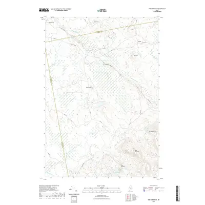
2021 Map of The Horseback
USGS Topo · Published 2021About this map
Sunkhaze Stream and Birch Stream meander through an expansive wetland landscape in this 2021 survey of the Maine backcountry. The terrain is defined by its glacial heritage, most notably The Horseback, a long esker ridge followed by Horseback Rd. This geologic feature serves as a natural corridor through the surrounding lowlands and bogs. Settlement is sparse, anchored by the location of Myra, while the uplands rise to the southeast with prominent peaks like Springy Brook Mtn and Bald Bluff Mtn. Historians and genealogists will find the Jackson Cem near Ten Hill as a significant point of local interest. The map documents a network of logging and access roads, including Stud Mill Rd and Pickerel Pond Rd, which connect remote water bodies like Pickerel Pond and East Great Works Pond to the broader Penobscot and Hancock county line.
Find a feature on this map
39 named features on this map. Tap any name to fly to it.
Don’t see what you’re looking for? This feature index may not catch every label — zoom into the map to look around manually.
Map Details
Editions of this 2021 The Horseback Map
This is the sole edition of this map. No revisions or reprints were ever made.
Other maps of this area

1902 · Orono
USGS Topo · 1:62,500

1917 · Passadumkeag
USGS Topo · 1:62,500

1929 · Great Pond
USGS Topo · 1:48,000

1931 · Saponac
USGS Topo · 1:48,000

1932 · Great Pond
USGS Topo · 1:62,500

1934 · Saponac
USGS Topo · 1:62,500

1944 · Orono
USGS Topo · 1:62,500

1946 · Orono
USGS Topo · 1:62,500

1948 · Bangor
USGS Topo · 1:250,000

1954 · Millinocket
USGS Topo · 1:250,000