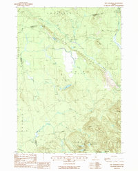
1988 Map of The Horseback
USGS Topo · Published 1988About this map
The Horseback forms a striking glacial esker that snakes across this Hancock County landscape, defining the local geography as it runs parallel to Sunkhaze Stream. This 1980s survey captures a largely undeveloped wilderness at the intersection of Greenfield, Milford, and Bradley. The map is characterized by a dense network of water bodies, from the secluded Crocker Pond and Pickerel Pond in the north to the expansive East Great Works Pond and Trout Pond at the base of Trout Pond Mtn. Small-scale industrial activity is evidenced by a Gravel Pit near Madden Hill, while the interior remains accessible primarily via unimproved roads like Saddleback Bk. Significant elevations such as Bald Bluff Mtn and Bear Den Hill provide clear reference points for those studying the physical evolution of this Maine timber and wetlands region.
Find a feature on this map
37 named features on this map. Tap any name to fly to it.
Don’t see what you’re looking for? This feature index may not catch every label — zoom into the map to look around manually.
Map Details
Editions of this 1988 The Horseback Map
This is the sole edition of this map. No revisions or reprints were ever made.
Other maps of this area

1902 · Orono
USGS Topo · 1:62,500

1917 · Passadumkeag
USGS Topo · 1:62,500

1929 · Great Pond
USGS Topo · 1:48,000

1931 · Saponac
USGS Topo · 1:48,000

1932 · Great Pond
USGS Topo · 1:62,500

1934 · Saponac
USGS Topo · 1:62,500

1944 · Orono
USGS Topo · 1:62,500

1946 · Orono
USGS Topo · 1:62,500

1948 · Bangor
USGS Topo · 1:250,000

1954 · Millinocket
USGS Topo · 1:250,000