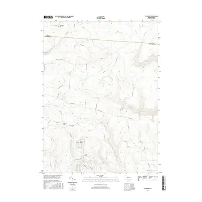
2016 Map of The Knobs
USGS Topo · Published 2016About this map
The Knobs rise above the high plateau along the border of Elk and Clearfield Counties, anchoring a landscape defined by significant timber and resource access routes. The prominence of Big Knob and Little Knob overlooks a dense network of forest roads and historic thoroughfares such as Caledonia Pike and Jack Dent Rd. These routes, alongside names like Munn Farm Rd and Orchard Camp Rd, hint at the land's history of agricultural and seasonal use within the Pennsylvania wilds.
Find a feature on this map
67 named features on this map. Tap any name to fly to it.
Don’t see what you’re looking for? This feature index may not catch every label — zoom into the map to look around manually.
Map Details
Editions of this 2016 The Knobs Map
This is the sole edition of this map. No revisions or reprints were ever made.
Other maps of this area

1929 · Karthaus
USGS Topo · 1:62,500

1929 · Clearfield
USGS Topo · 1:48,000

1932 · Clearfield
USGS Topo · 1:62,500

1932 · Karthaus
USGS Topo · 1:62,500

1941 · Benezette
USGS Topo · 1:62,500

1943 · Benezette
USGS Topo · 1:62,500

1945 · Driftwood
USGS Topo · 1:48,000

1945 · Driftwood
USGS Topo · 1:24,000
1947 · Driftwood
USGS Topo · 1:24,000

1957 · Warren
USGS Topo · 1:250,000