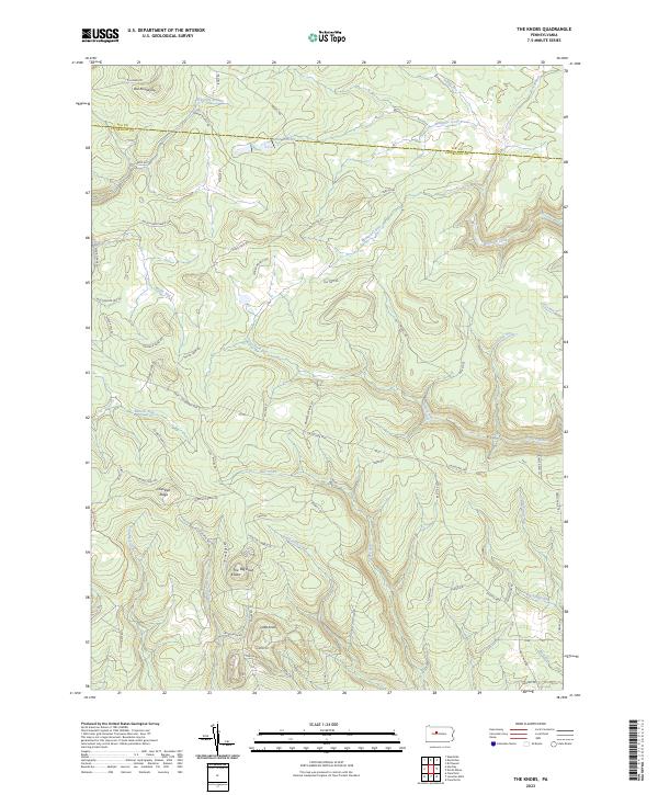
2023 Map of The Knobs
USGS Topo · Published 2023About this map
High elevations and dense waterway networks characterize this portion of Clearfield and Elk Counties, dominated by the prominent peaks of The Big Knob and Little Knob. The landscape is a complex of deep runs and ridges, where the Elk Co Clearfield Co line bisects the northern terrain. Significant riparian features like the Duck Marshes and Mosquito Creek suggest the drainage patterns that have historically shaped land use in this part of the Allegheny Plateau.
Find a feature on this map
72 named features on this map. Tap any name to fly to it.
Don’t see what you’re looking for? This feature index may not catch every label — zoom into the map to look around manually.
Map Details
Editions of this 2023 The Knobs Map
This is the sole edition of this map. No revisions or reprints were ever made.
Other maps of this area

1929 · Karthaus
USGS Topo · 1:62,500

1929 · Clearfield
USGS Topo · 1:48,000

1932 · Clearfield
USGS Topo · 1:62,500

1932 · Karthaus
USGS Topo · 1:62,500

1941 · Benezette
USGS Topo · 1:62,500

1943 · Benezette
USGS Topo · 1:62,500

1945 · Driftwood
USGS Topo · 1:48,000

1945 · Driftwood
USGS Topo · 1:24,000
1947 · Driftwood
USGS Topo · 1:24,000

1957 · Warren
USGS Topo · 1:250,000