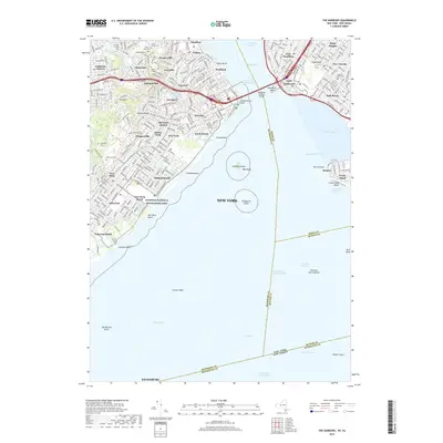
2019 Map of The Narrows
USGS Topo · Published 2019About this map
Fort Hamilton stands as a sentinel at the eastern anchor of the Verrazano-Narrows Bridge, overlooking the critical maritime passage that separates Staten Island from Brooklyn. This modern topographic view reveals the dense residential patterns across neighborhoods such as Grasmere, Dongan Hills, and New Utrecht, while preserving significant historical footprints through its network of cemeteries. Local genealogy is anchored by sites like the Old New Utrecht Cem and the sprawling Moravian Cem in the hills. The map highlights the coastal interface between the urban grid and the Atlantic, specifically at the Gateway National Recreation Area. Off the coast of South Beach, the artificial forms of Hoffman Island and Swinburne Island remain prominent landmarks within the Lower Bay, marking the approach to the Ambrose Channel and the busy harbor waters of The Narrows.
Find a feature on this map
85 named features on this map. Tap any name to fly to it.
Don’t see what you’re looking for? This feature index may not catch every label — zoom into the map to look around manually.
Map Details
Editions of this 2019 The Narrows Map
This is the sole edition of this map. No revisions or reprints were ever made.
Other maps of this area

1888 · Sandy Hook
USGS Topo · 1:62,500

1889 · Brooklyn
USGS Topo · 1:62,500

1891 · Brooklyn
USGS Topo · 1:62,500

1893 · Sandy Hook
USGS Topo · 1:62,500

1897 · Brooklyn
USGS Topo · 1:62,500

1898 · Staten Island
USGS Topo · 1:62,500

1898 · Brooklyn
USGS Topo · 1:62,500

1900 · Passaic
USGS Topo · 1:125,000

1900 · Staten Island
USGS Topo · 1:62,500

1900 · Brooklyn
USGS Topo · 1:62,500