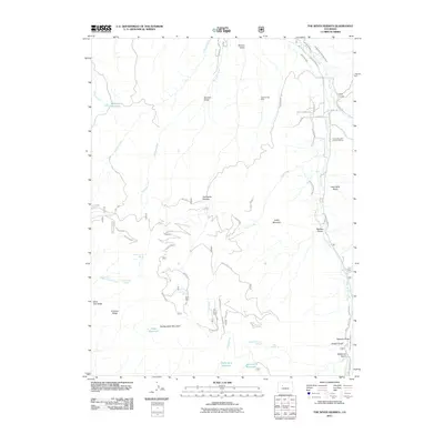
2011 Map of The Seven Hermits
USGS Topo · Published 2011About this map
Ground Hog Mine and the Horse Mountain Uranium Mines define the industrial history of this high mountain landscape south of Eagle. The area's complex water management system is visible through a network of irrigation features including the Staten and Cisna Ditch, McKenzie Ditch, and Peterson Ditch Number 1. These engineered waterways diverted flow from Brush Creek and its tributaries to support high-altitude ranching and mining operations.
Find a feature on this map
56 named features on this map. Tap any name to fly to it.
Don’t see what you’re looking for? This feature index may not catch every label — zoom into the map to look around manually.
Map Details
Editions of this 2011 The Seven Hermits Map
This is the sole edition of this map. No revisions or reprints were ever made.
Other maps of this area

1909 · Mount Jackson
USGS Topo · 1:125,000

1911 · Mount Jackson
USGS Topo · 1:125,000

1957 · Leadville
USGS Topo · 1:250,000

1959 · Leadville
USGS Topo · 1:250,000

1960 · Leadville
USGS Topo · 1:250,000
1961 · Toner Reservoir
USGS Topo · 1:24,000

1961 · Red Creek
USGS Topo · 1:24,000

1962 · Leadville
USGS Topo · 1:250,000

1962 · Gypsum
USGS Topo · 1:24,000
1962 · Suicide Mountain
USGS Topo · 1:24,000