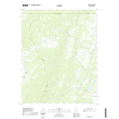
2020 Map of The Wall
USGS Topo · Published 2020About this map
The Wall rises as a prominent geographic feature along the border of Colfax and Taos counties, marking a high-elevation terrain where the Sangre de Cristo Mountains transition toward the Vermejo River drainage. This 2020 landscape is defined by its complex hydrology, with numerous high-altitude basins holding Underwood Lakes, Bernal Lake, and Adams Lake. The survey captures the intersection of several remote mountain routes, including Munn Lake Rd and Leandro Rd, which navigate the steep grades near Vermejo Peak. The map illustrates a network of seasonal streams such as Gold Cr and Bernal Cr that feed into the larger river systems. Further south, Castle Rock Park provides a distinct break in the topography, serving as a landmark for those tracking the historical land use and travel patterns through this part of Northern New Mexico.
Find a feature on this map
32 named features on this map. Tap any name to fly to it.
Don’t see what you’re looking for? This feature index may not catch every label — zoom into the map to look around manually.
Map Details
Editions of this 2020 The Wall Map
This is the sole edition of this map. No revisions or reprints were ever made.
Other maps of this area

1954 · Raton
USGS Topo · 1:250,000

1954 · Trinidad
USGS Topo · 1:250,000

1955 · Trinidad
USGS Topo · 1:250,000

1958 · Raton
USGS Topo · 1:250,000

1958 · Trinidad
USGS Topo · 1:250,000

1959 · Trinidad
USGS Topo · 1:250,000

1962 · Ash Mountain
USGS Topo · 1:62,500

1963 · Comanche Point
USGS Topo · 1:24,000

1963 · Big Costilla Peak
USGS Topo · 1:24,000

1967 · La Valley
USGS Topo · 1:24,000