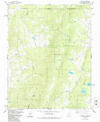
1986 Map of The Wall
USGS Topo · Published 1986About this map
The Beaubien and Miranda (Maxwell) Grant Boundary defines much of this high-elevation landscape along the border of Colorado and New Mexico. This 1986 revision illustrates a region of complex hydrology and mineral history, marked by high peaks such as Vermejo Peak and the prominent topographic features of The Wall and Little Wall. The area is characterized by an extensive system of alpine lakes, including Underwood Lakes, Bernal Lake, Munn Lake, and Adams Lake, which feed the drainages of Costilla Creek and the North Fork Vermejo River. Resource extraction and land use are evident through the Van Lint Mine, a remote Cemetery, and scattered infrastructure like a Drill Hole and Corral. A network of 4WD tracks and a Trail navigate the steep grades of Cherokee Canyon and the Sangre de Cristo range, connecting high meadows like Castle Rock Park.
Find a feature on this map
33 named features on this map. Tap any name to fly to it.
Don’t see what you’re looking for? This feature index may not catch every label — zoom into the map to look around manually.
Map Details
Editions of this 1986 The Wall Map
This is the sole edition of this map. No revisions or reprints were ever made.
Other maps of this area

1954 · Raton
USGS Topo · 1:250,000

1954 · Trinidad
USGS Topo · 1:250,000

1955 · Trinidad
USGS Topo · 1:250,000

1958 · Raton
USGS Topo · 1:250,000

1958 · Trinidad
USGS Topo · 1:250,000

1959 · Trinidad
USGS Topo · 1:250,000

1962 · Ash Mountain
USGS Topo · 1:62,500

1963 · Comanche Point
USGS Topo · 1:24,000

1963 · Big Costilla Peak
USGS Topo · 1:24,000

1967 · La Valley
USGS Topo · 1:24,000