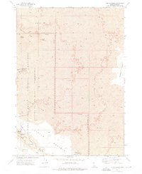
1973 Map of The Watchman
USGS Topo · Published 1976About this map
The volcanic landscape of the Craters of the Moon National Monument dominates this 1970s survey, revealing a complex network of geological formations and subterranean passages. Substantial lava flows are punctuated by unique features such as the Tom Thumb Tunnel and the Lava River Cave, illustrating the area's recent volcanic history. Notable landmarks like The Watchman and The Sentinel provide vertical relief against the expansive fields of Lava.
Find a feature on this map
23 named features on this map. Tap any name to fly to it.
Don’t see what you’re looking for? This feature index may not catch every label — zoom into the map to look around manually.
Map Details
Editions of this 1973 The Watchman Map
This is the sole edition of this map. No revisions or reprints were ever made.
Other maps of this area

1935 · MacKay
USGS Topo · 1:96,000

1955 · Idaho Falls
USGS Topo · 1:250,000

1958 · Idaho Falls
USGS Topo · 1:250,000

1960 · Grouse
USGS Topo · 1:62,500

1972 · North Laidlaw Butte
USGS Topo · 1:24,000

1972 · Pratt Butte
USGS Topo · 1:24,000

1972 · Arco South
USGS Topo · 1:24,000

1972 · Nichols Reservoir
USGS Topo · 1:24,000

1972 · Fingers Butte
USGS Topo · 1:24,000

1972 · Inferno Cone
USGS Topo · 1:24,000