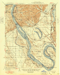
1934 Map of Thebes
USGS Topo · Published 1948About this map
Thebes stands as a prominent rail and river hub along the Mississippi River in this detailed survey of southern Illinois. The landscape is defined by the complex hydrology of the river bottomlands, where numerous chutes and towheads like Burnham Island and Thompson Towhead shift the navigable channels. To the east, the Horseshoe Lake region is preserved as the State Game Preserve, while the surrounding terrain is dotted with rural infrastructure from the early 20th century, including the Mt Zion Ch and an Indian Mound near Lake Milligan.
Find a feature on this map
96 named features on this map. Tap any name to fly to it.
Don’t see what you’re looking for? This feature index may not catch every label — zoom into the map to look around manually.
Map Details
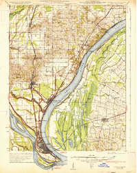
Editions of this 1934 Thebes Map
4 editions found
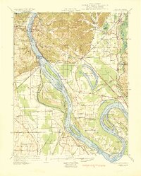
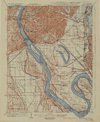
Other maps of this area

1920 · Jonesboro
USGS Topo · 1:62,500

1920 · Dongola
USGS Topo · 1:62,500

1922 · Cape Girardeau
USGS Topo · 1:62,500

1923 · Dongola
USGS Topo · 1:62,500

1923 · Jonesboro
USGS Topo · 1:62,500

1924 · Cape Girardeau
USGS Topo · 1:62,500

1931 · Sikeston
USGS Topo · 1:62,500

1931 · Cairo
USGS Topo · 1:62,500
1933 · Cairo
USGS Topo · 1:62,500

1934 · Thebes
USGS Topo · 1:62,500